Webinar: Measuring vegetation structure with airborne LiDAR
How can we measure vegetation structure with LiDAR point clouds? Examples from European countries and nature reserves
Date: Thursday, October 16th, 2025
Time: 13:00 CEST
Duration: 1 hour
Location: Online via Zoom (free, registration required)
Capacity: Limited to 300 participants.
About the webinar:
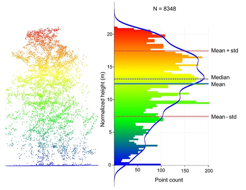
This webinar explores how airborne LiDAR can be used to measure and map vegetation structure in ecological and biodiversity research. The session will begin with briefly introducing airborne laser scanning technology and its potential for ecology, and then showcase three practical applications from European countries and nature reserves:
- Measuring trail networks of large herbivores
- Mapping the spatial distribution of 3D vegetation structures
- Identifying and mapping individual trees
This webinar is designed for ecologists, reserve managers, biodiversity consultants, environmental practitioners, academics, PhD students, and anyone interested in land-use planning, conservation, and ecosystem monitoring.
By the end, participants will gain not only practical insights into applying LiDAR in ecology but also access to resources, including scientific papers, datasets, and code, to support further exploration.
Discover how LiDAR is transforming biodiversity monitoring and ecosystem science - join us to learn how you can apply it in your work.
Registration
Participation is free but registration is required, but capacity is limited to 300 participants. The Zoom link will be sent to registered participants.
Registration form: https://uva-live.zoom.us/meeting/register/n8VU-ROjTcuT8ADmcGIAdA