Webinar: GeoPl@nNET
GeoPl@nNET Webinar
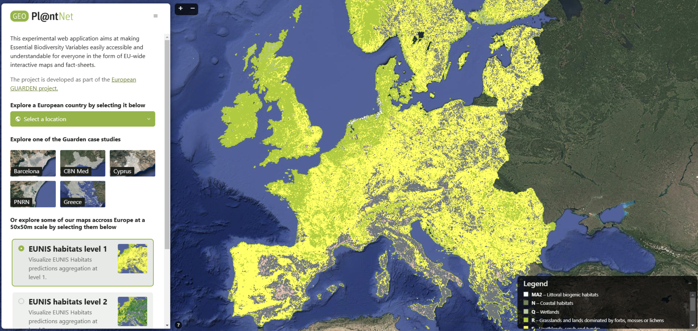
High-resolution maps of habitats, plant species distributions and diversity metrics for Europe
Date: Thursday, October 9th, 2025
Time: 2:00 PM (UTC+2)
Duration: 1 hour
Location: Online via Zoom (free, registration required)
Capacity: Limited to 50 participants
About the Webinar
The lack of systematic monitoring of habitats and plant communities at high spatial resolution for Europe remains a major barrier to effective land-use planning and conservation strategies.
We are pleased to present GeoPl@nNET, a new web application designed to support both biodiversity stakeholders and scientists. GeoPl@nNET was notably developed within the MAMBO project, and provides high-resolution (50 m) predictive maps for European habitats (EUNIS level 1 to 3), the potential presence of nearly 5,000 plant species, and a range of biodiversity indicators.
This one-hour interactive webinar will:
- Introduce the data, algorithms, and workflow behind GeoPl@nNET
- Demonstrate the tool's main features
- Provide short exercises to help participants explore its practical applications
Whether you work in biodiversity consulting, land-use planning, reserve management, research, or simply interested in biodiversity data and mapping, this session will offer a hands-on introduction to a powerful new tool.
Programme
- Behind the scene of GeoPl@nNET
Presentation of the data, models, pipeline, and evaluation + Q&A (15 minutes) - Demonstration and hands-on session
Live demo of the app, guided exercises, and interactive Q&A (45 minutes)
Registration
Participation is free but registration is required. Capacity is limited, and the Zoom link will be sent to confirmed participants a few days before the event.
Registration form: https://framaforms.org/geoplntnet-webinar-9th-of-october-2025-1755184484
![]()